

Day 2 was definitely a little better than the first day. We finally arrived at Jasper National Park, to visit the fringe of Mount Robson National Park, the Athabasca Falls, Columbia Icefield, Peyto Lake, and Lake Louise – all this in 8 hours!
We started off early with a 5 AM wake up call but the sky was quite colorful already.

We had a 6:30 AM breakfast – Seaweed Soup, Mi yuk guk 미역국! It is Korean tradition to eat seaweed soup on your birthday. Seaweed soup is actually eaten by women who just gave birth because it has iodine and iron to help the mother recover from her labour. Therefore, everyone drinks seaweed soup on their birthday to thank their mother for giving birth to them. I was curious, so I looked it up …

More sitting and staring at the window ensures but the view was much better now that we’ve entered the Rockies.
Our first stop was at a visitor center at Mount Robson Provincial Park. The center wasn’t open yet but we took in the sights – the first of many. Mount Robson has the highest peak of the Canadian Rockies at 3,954 meters.


Interestingly, Mount Robson can be climbed, although its failure rate is said to be as high as 90% (per wiki).


There are actually other peaks at Mount Robson, but it seems like they have been overshadowed, however, this mountain has a cute name – Cinnamon Peak!
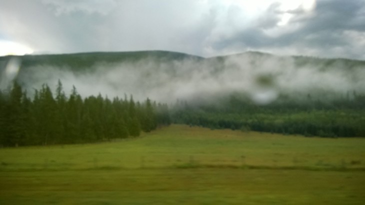
Back on the road we go! Rolling trees and endless greenery . There are always clouds hanging around the mountains peaks … possibly because we are at a higher elevation ourselves too.
")


One of my favorite ‘on-the bus’ motion pictures:

The tour guide also put on some music
In our next stop, we have officially entered Jasper National Park and the Athabasca Falls! Walking from the parking lot towards the falls, we were already at awed with the sight.


Athabasca Falls was naturally created when the Athabasca River is pushed through a narrow gorge and dropped down a cliff. The walking path is surprisingly close to the edge of the waterfall.


It looks better the further up you go 🙂
Final up-close pic of the waterfall …

Since the water is actually eroding the rocks, the waterfall has been moving steadily upstream. Therefore, there is actually a lower trail that was created by this gushing water. The water had eroded the weaker rocks, leaving all these odd carvings.


At the end of the trail is a split, one going to a pothole and another to the view of the river. This is the pothole, a hole where there is no way for water to leave.

The other side is the Athabasca River going about its journey once more, as well as another rock formation.
The last straight down look at the Athabasca Fall before departing.

… and back to the bus we go for more views from within …
To be continued …
August 2016

One thought on “Canadian Rockies: Jasper National Par k – Mountains & the Athabasca Falls”